
Castaway Island Preserve | Coastal Ecology & Aerial Perspective
Project Overview
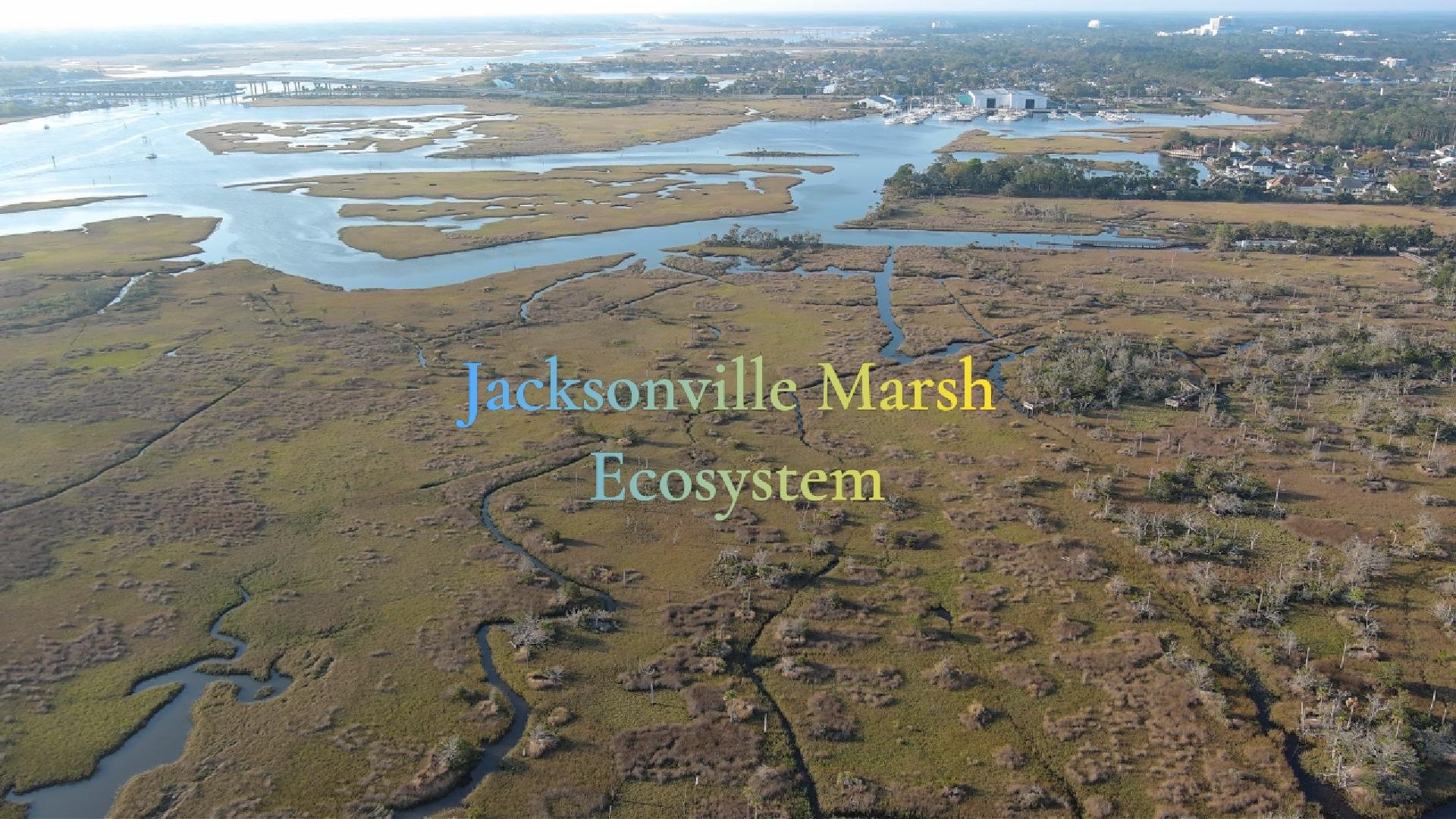
Castaway Island Preserve is a protected coastal ecosystem located along the St. Johns River in Jacksonville, Florida. The preserve's network of tidal marshes, estuarine waterways, maritime forests, and elevated hammocks provides a living example of how coastal environments continually evolve through the interaction of water, vegetation, wildlife, and climate.
This Eos Astraeus® project combines aerial storytelling with environmental perspective to reveal the preserve as an interconnected ecological system rather than simply a recreational destination. By pairing cinematic drone imagery with geographic context, the project demonstrates how aerial perspective can deepen our understanding of coastal resilience, conservation, and the natural processes shaping these environments.
Why This Project Matters
Coastal ecosystems are among the most productive and environmentally significant landscapes in North America. Tidal marshes filter water, reduce erosion, provide wildlife habitat, and help protect surrounding communities from storm impacts while supporting diverse plant and animal species.
Understanding these systems requires more than a ground-level view. From above, the relationships between waterways, wetlands, vegetation, and surrounding development become far easier to recognize, allowing viewers to appreciate how these natural systems function together.
Environmental Perspective
Castaway Island Preserve demonstrates the dynamic relationship between freshwater and saltwater environments, tidal movement, and the ecological processes that sustain coastal habitats. The preserve illustrates how geography, hydrology, and vegetation interact to create resilient ecosystems that continue adapting to changing environmental conditions.
Rather than focusing solely on scenic beauty, this project highlights the importance of preserving natural landscapes while improving public understanding of the ecological systems that support them.
Why Aerial Perspective Matters
Many of the preserve's defining characteristics cannot be fully appreciated from ground level. Aerial imagery provides a broader perspective that reveals the scale, connectivity, and complexity of the landscape.
Through drone-based visualization, viewers gain a better understanding of:
The relationship between marshes, waterways, and upland forests
Natural drainage patterns and tidal influence
Habitat connectivity across the preserve
The interaction between conservation areas and surrounding development
The overall scale and organization of the coastal ecosystem
This perspective helps transform environmental concepts into visual understanding, making complex natural systems easier to interpret and appreciate.
Technologies Used
FAA Part 107 Certified Remote Pilot
Professional UAS aerial imaging
Cinematic aerial video production
Geographic and environmental research
Professional post-production editing