Project Overview
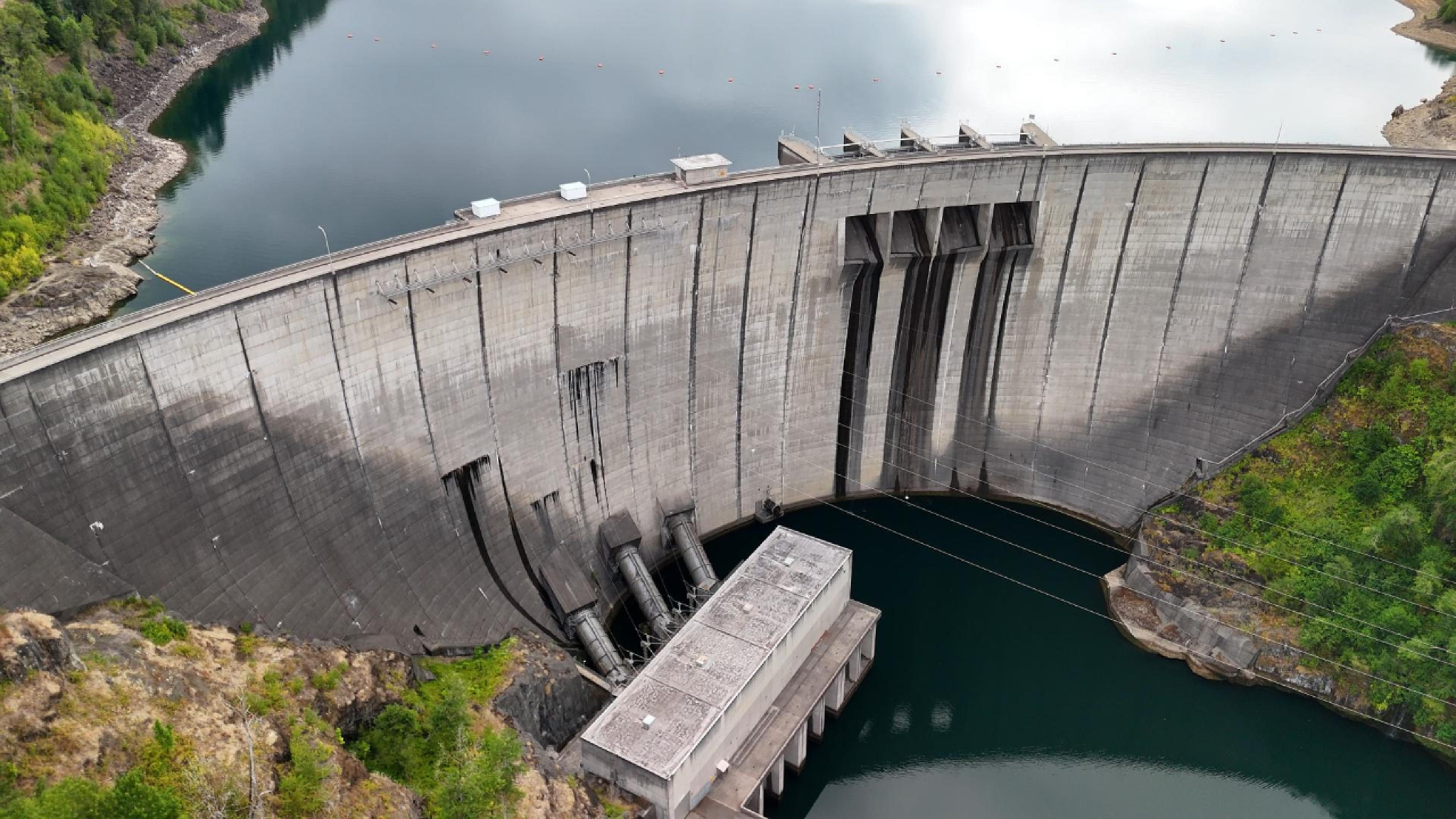
Standing over 600 feet above the Cowlitz River, Mossyrock Dam is one of the tallest dams in the Pacific Northwest and a critical component of Washington's hydroelectric infrastructure. More than a massive concrete structure, it represents the integration of engineering, renewable energy, flood management, and regional water resource planning.
This Eos Astraeus project combines aerial storytelling with engineering insight to explain how the infrastructure of this scale functions within its surrounding environment. By pairing cinematic drone imagery with technical context, the project demonstrates how aerial perspective can transform complex engineering systems into a clear visual understanding.
Why This Project Matters
Large infrastructure is often experienced from a single viewpoint. From the ground, it is difficult to appreciate the true scale, geography, and engineering relationships that define these systems.
Through aerial visualization, viewers can better understand:
The overall scale of Mossyrock Dam
The relationship between the dam, reservoir, and surrounding terrain
How elevation enables hydroelectric power generation
Why geography plays a critical role in energy production
The importance of long-term infrastructure planning
Mossyrock Dam: Engineering, Energy & Aerial Perspective
Engineering Perspective
Hydroelectric facilities convert the gravitational potential energy of stored water into renewable electricity. Mossyrock Dam demonstrates how civil engineering, environmental planning, and energy infrastructure work together to provide reliable power while supporting flood control, water storage, and regional resource management.
Rather than focusing solely on technical specifications, this project explains the engineering principles behind the facility and illustrates them through an aerial perspective.
Why Aerial Perspective Matters
Engineering systems are easier to understand when viewed as complete systems rather than isolated components.
Drone-based visualization provides perspectives that traditional ground photography often cannot, helping communicate:
Infrastructure scale
Terrain relationships
Water flow and reservoir context
Access routes
Environmental integration
Engineering intent